 Geosur
Indian Ocean
Type of resources
Topics
INSPIRE themes
Keywords
Contact for the resource
Provided by
Years
Formats
Representation types
Update frequencies
status
Scale
-
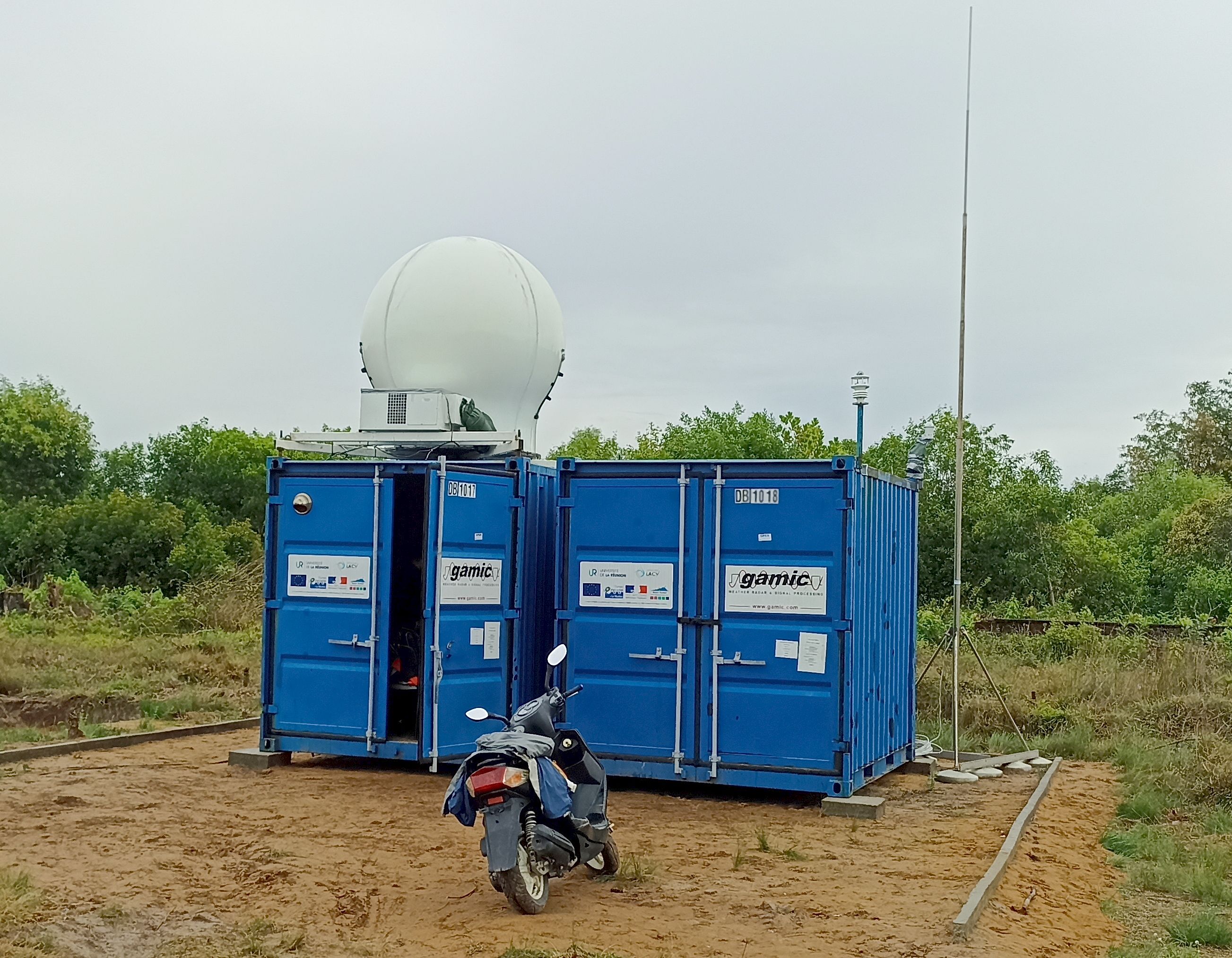
The ressource describes the dataset obtained by deploying the GAMIC GMWR-25-DP RADAR in the South of Reunion Island, in Saint Joseph.
-
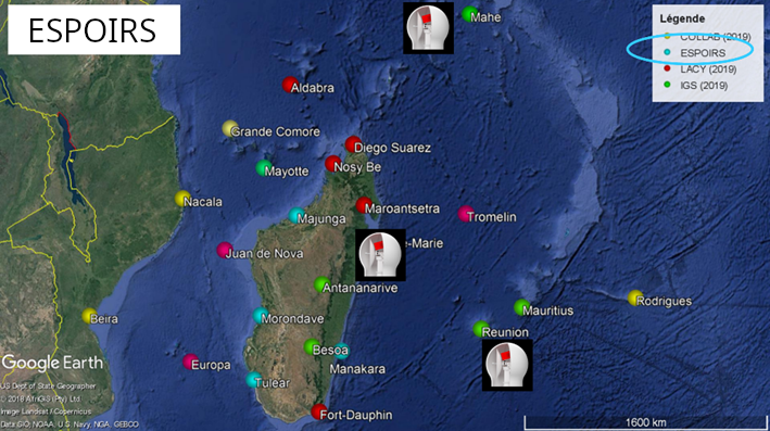
This ressource is part of the action 1 of the ESPOIRS Project. Multiple GNSS Stations have been installed or updated in the SWIO and the data are available here. "TO ADD : Different datasets, list of stations, etc ...."
-
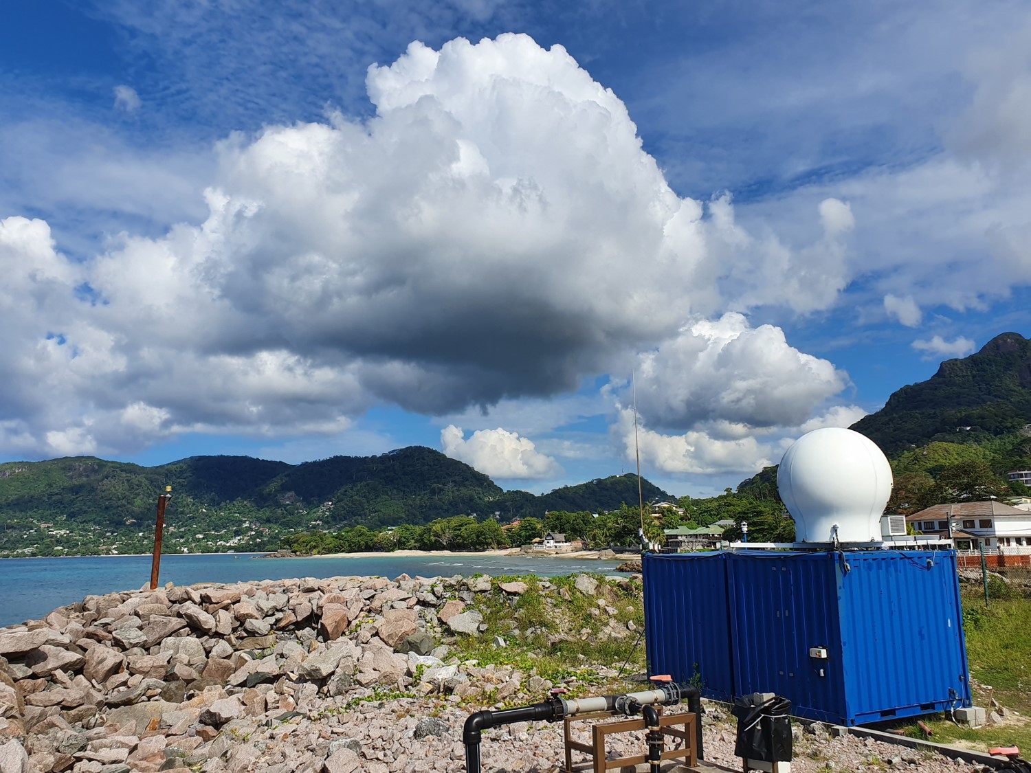
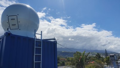
The ressource describes the dataset obtained by deploying the GAMIC GMWR-25-DP RADAR in the north of Mahé Island, in Seychelles.
-

This dataset encompasses model outputs generated by the Weather Research and Forecasting (WRF) regional climate model. A high-resolution (~1km) downscaling simulation was performed over two tropical islands, Reunion and Mauritius, situated in the South-West Indian Ocean (SWIO), with initial and boundary conditions provided by the ERA5 reanalysis with a global resolution of 0.25° × 0.25°. The simulation used three nested domains sequentially configured with spatial resolutions of 9, 3, and 1km, respectively, with a downscaling ratio of 3. The physical configurations of this simulation were determined through previous modeling studies and sensitivity tests. The published simulation data currently covers a period of 10 years, starting from 1991 (with the possibility to be extended to 30 years). Over 60 output variables were selected for publication with open access, including those related to the intermittent energy resources (e.g., surface solar radiation and its direct/diffuse components, wind speed/direction at multiple vertical levels, and precipitation, of interest for the run-off-river hydropower), as well as the widely used climatic/meteorological variables (e.g., temperature, pressure, humidity, etc.) at a temporal resolution varying from a day up to 30 minutes. All the data are available through an open-access data server, where an intelligent algorithm is applied to simplify the download process for data users. For the first time, a long-term, high-resolution climate/meteorological dataset covering Reunion and Mauritius has been simulated and published as open-access data, yielding substantial benefits to studies on climate modeling, weather forecasting, and even those related to climate change in the SWIO region. In particular, this dataset will enable a better understanding of the temporal and spatial characteristics of intermittent climate-related energy resources, consequently facilitating their implementation towards a green and low-carbon future.
-

The overall objective of the ESPOIRS project is to obtain a better understanding of the variability, statistical properties and formation mechanisms of intense tropical precipitation at regional and local scales. ESPOIRS is thus interested in the entire life cycle of precipitation at several space-time scales. * Through the analysis of the distribution of the large-scale humidity field which drives the formation of precipitation at the regional scale using a GNSS network. * Through the characterization of internal (dynamics, microphysics) and external (interactions with the relief) processes, which drive the formation and life cycle of extreme weather events at the local scale => transportable Polarized Doppler X-band precipitation radar.
-
The ressource describes the dataset obtained by deploying the GAMIC GMWR-25-DP RADAR in Toamasina (Tamatave) in Madagascar.
-
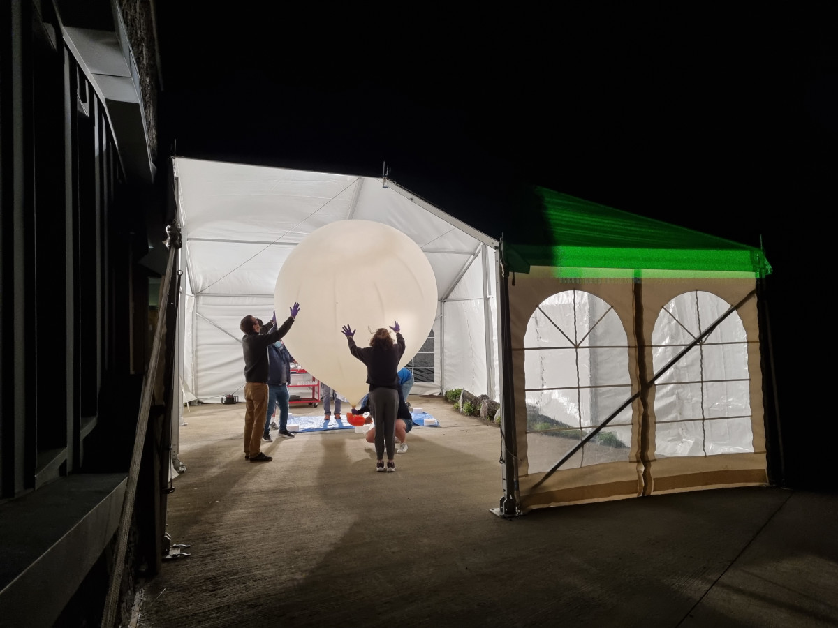
This dataset provides the processed CFH water vapor radiosoundings performed for 5 consecutive nights at the Maïdo Observatory (21.08°S, 55.38°E) on Réunion Island during the period 20-25 January 2022 following the eruption of the Hunga Tonga volcano on 15 January. Réunion Island is in the Southwest Indian Ocean and holds one of the very few atmospheric observatories in the subtropical Southern Hemisphere.
-

The coastline or shoreline is the geographical boundary between sea and land. It corresponds according to the SHOM to "the leash of the highest seas in the context of an astronomical tide of coefficient 120 and under normal weather conditions (without overcost phenomenon). The coastline as defined above is not directly identifiable continuously on the ground or on a satellite or aerial image. From a perspective of studying the displacement of the shoreline, indicators allow us to approach this notion (the vegetation limit associated with the infrastructure limit, the beach limit, etc.). On the reef shoreline of Reunion Island the limit of vegetation and infrastructure as well as beach limit were retained. This limit results in the production of a line-type vector geographic information layer in a GIS resulting from the photo-interpolation on Pléiades satellite images. Pleiades satellite images from the Kalideos Réunion database (CNES) have been used since 2016 to study the position of the shoreline annually. Launched in 2011, Pléiades is a very high spatial resolution spatial image system (panchromatic optical instrument at 70 cm and 2.8 m multispectral) operating in the visible and near infrared with a swath of 20 km UMR Espace-Dev
-

The beach profile is a sectional representation of its topography. The beach topography and its dynamics (by beach profile or transect approach) is illustrated by the acquisition of altimetry data along a fixed profile. 22 profiles are regularly monitored on the reef coast of Reunion Island: 2 profiles per year before the swell seasons of summer and austral winter; the impact of the events of strong swells (cyclones, southern swells) is systematically measured on the labeled Dynalit sites and more sporadically on the other sites. The methodology deployed locally since 2012 involves two Topcon Hiper II receivers (base and mobile) and one Topcon FC-250 controller (field notebook).
-

The coastline or shoreline is the geographical boundary between sea and land. It corresponds according to the SHOM to "the leash of the highest seas in the context of an astronomical tide of coefficient 120 and under normal weather conditions (without overcost phenomenon). The coastline as defined above is not directly identifiable continuously on the ground or on a satellite or aerial image. From a perspective of studying the displacement of the shoreline, indicators allow us to approach this notion (the vegetation limit associated with the infrastructure limit, the beach limit, etc.). On the reef shoreline of Reunion Island the limit of vegetation and infrastructure as well as beach limit were retained. This limit results in the production of a line-type vector geographic information layer in a GIS resulting from photo-interpolation on the orthophotos of IGN also called BD ORTHO. BD ORTHO is a component of the RGE®. These are digital color orthophotos supplied in raster format (tiff, ecw, ..). An orthophotography is a digital image that has the same metrics as a map of the same projection for the same elements on the ground. They have been available since 1997 in Réunion with a five-year repeatability. Their spatial resolution increased from 1 m in 1997 to 50 cm in 2003. UMR Espace-Dev